Auto RTH and flight attitude adjustment
GPS Auto RTH: Equipped with GPS navigation function,
return to the takeoff waypoint in case of low battery or loss of
data link; independently adjust flight attitude.

Flight modes: Manual + Fully Autonomous + ……
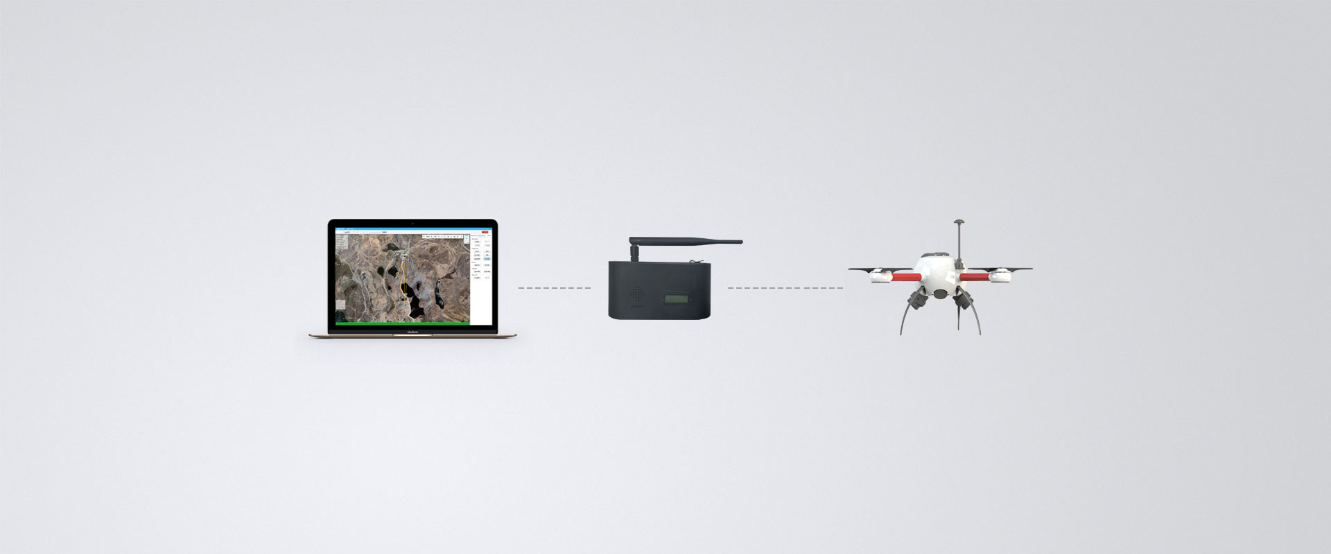
Our professional GCS provides real-time communication
between operators and the aircraft;
GCS controls the drone to
fly fully autonomously,
receives and displays information
related to the drone;
or by joystick remote control to accommodate the confined
environment.
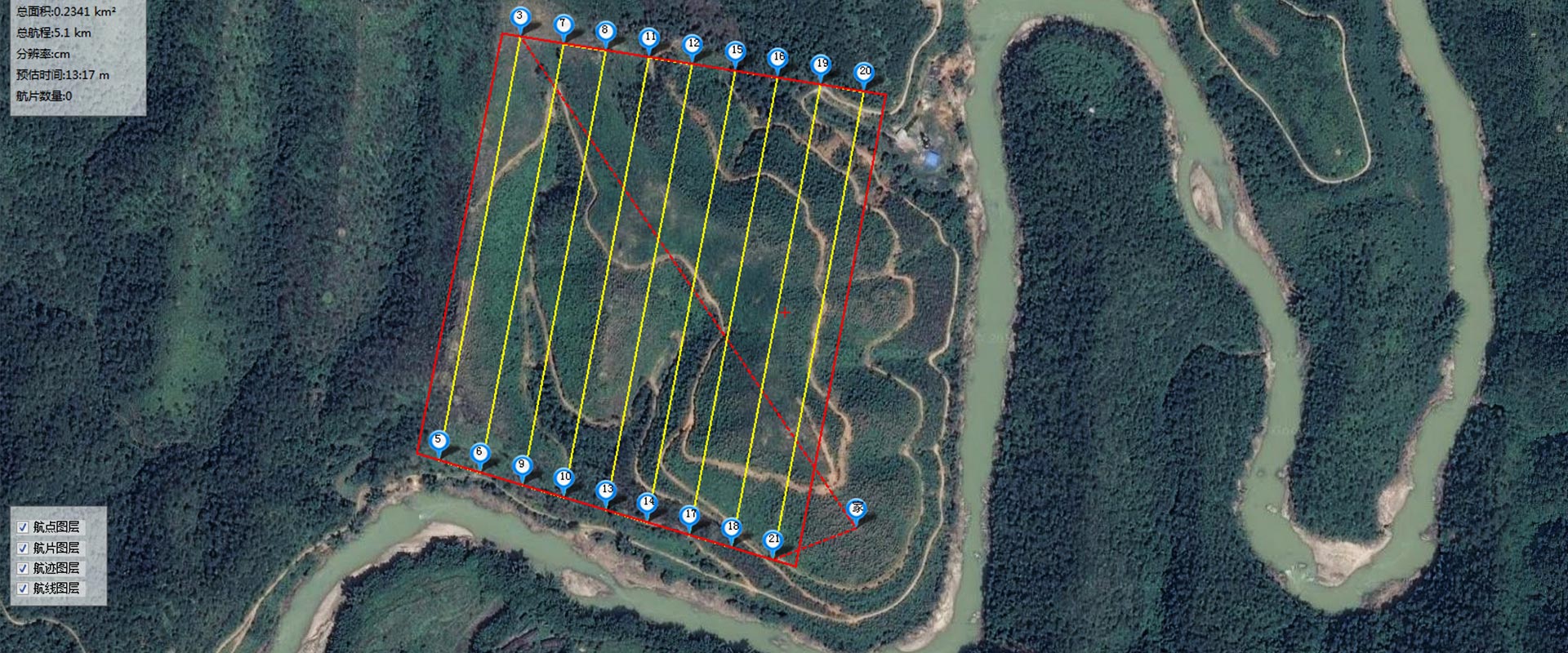
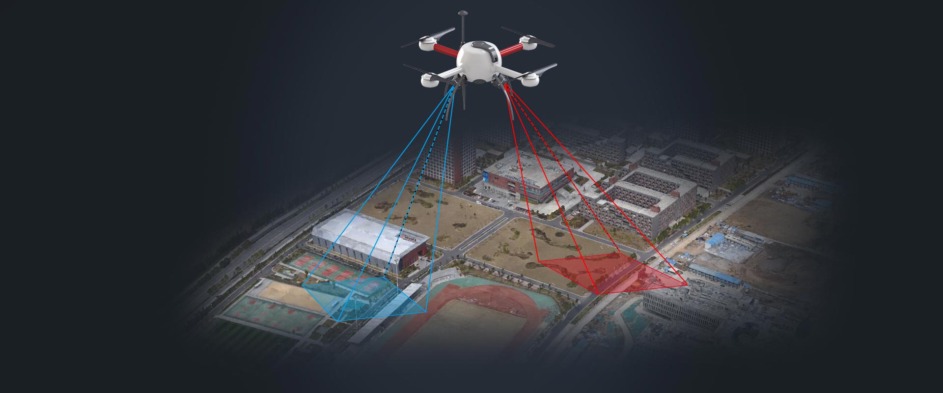
Intelligent flight
Fully autonomous VTOL, spot hovering when presetting waypoints,
automatically setting the flight path and altitude based on the
camera resolution.
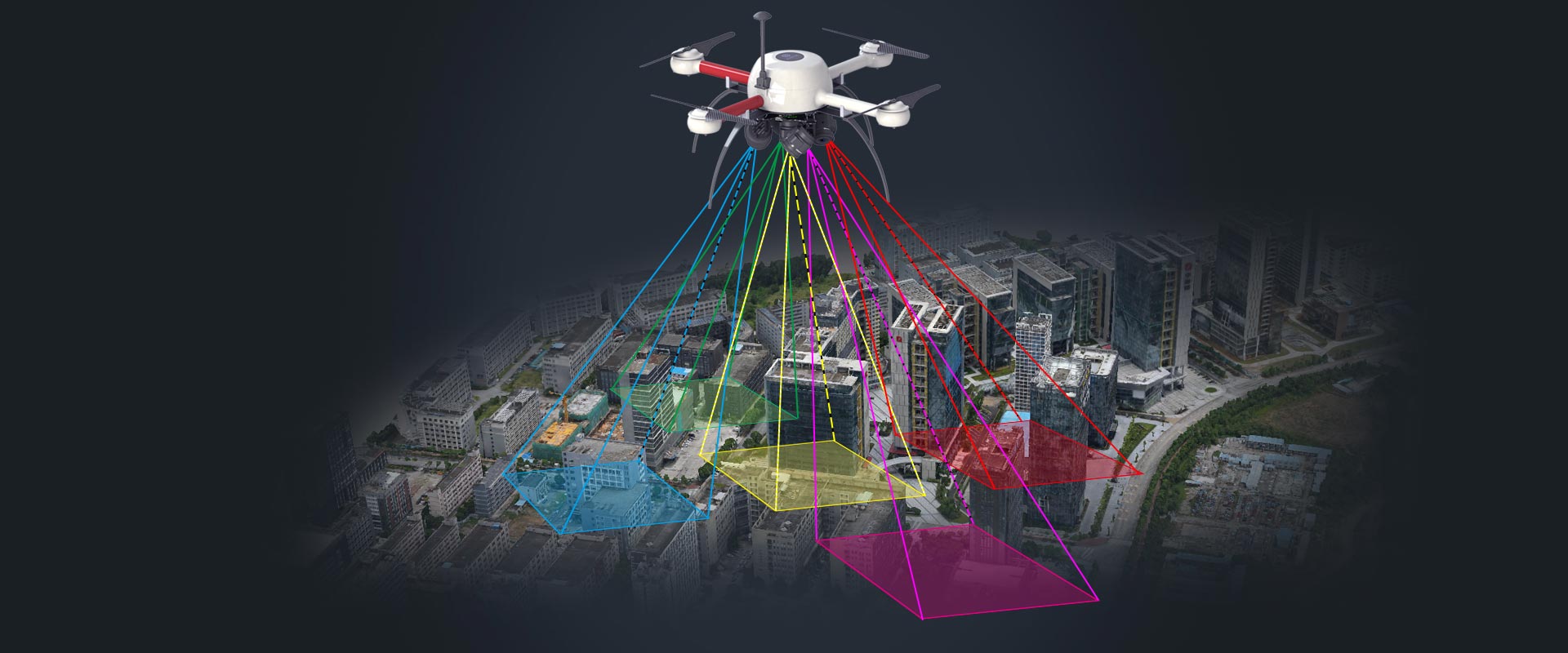
High-precision positioning
Self-developed high-precision RTK differential global positioning
system,
simultaneous acquisition of oblique and orthophoto
maps,
reducing 80% of the total GCPs, and collecting POS data with RTK.
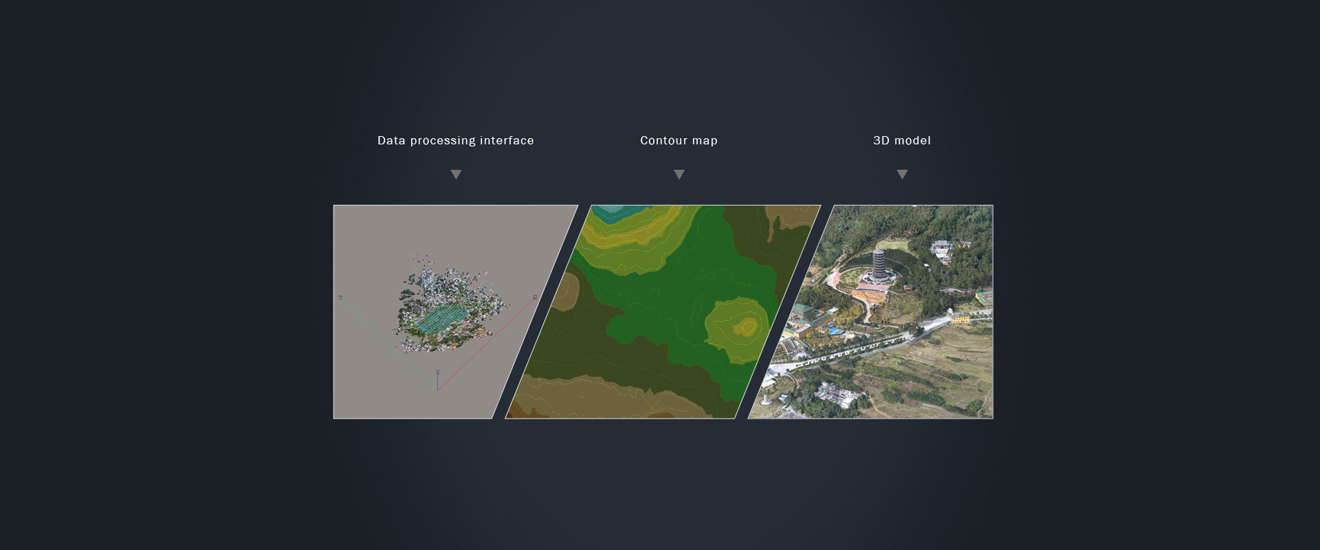
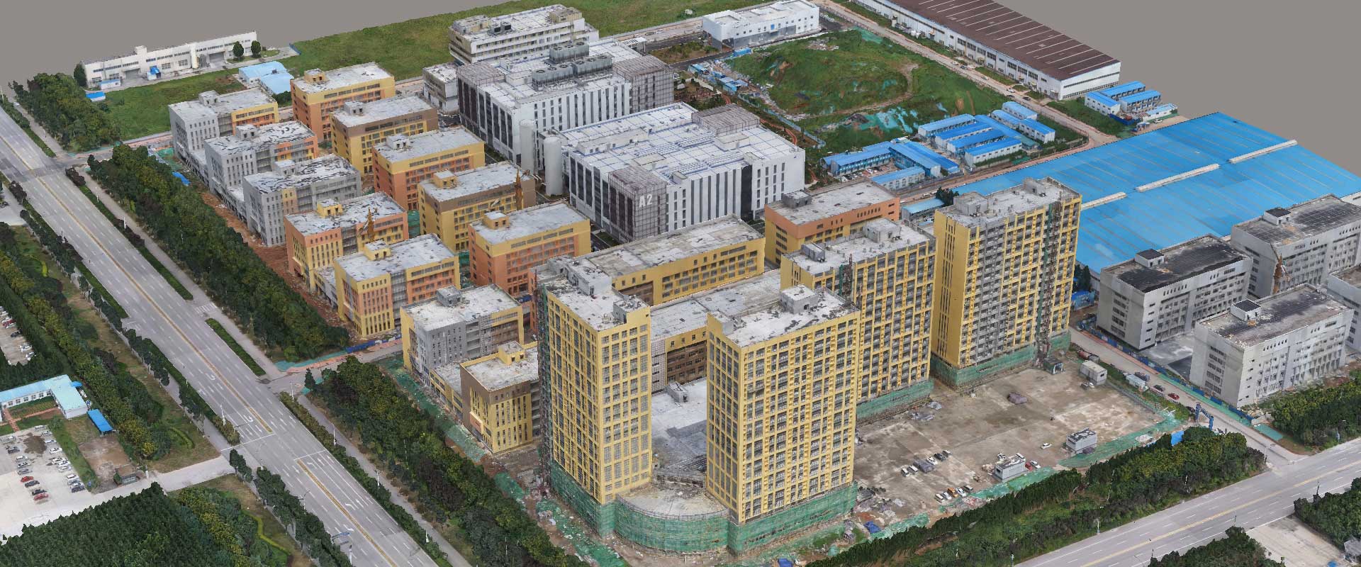
Professional data processing
We use professional data processors like Bentley Context Capture
and Pix4D to create useful 3D models,
rthophoto mosaic, DLG, topographic maps, DEM, contour maps, etc.