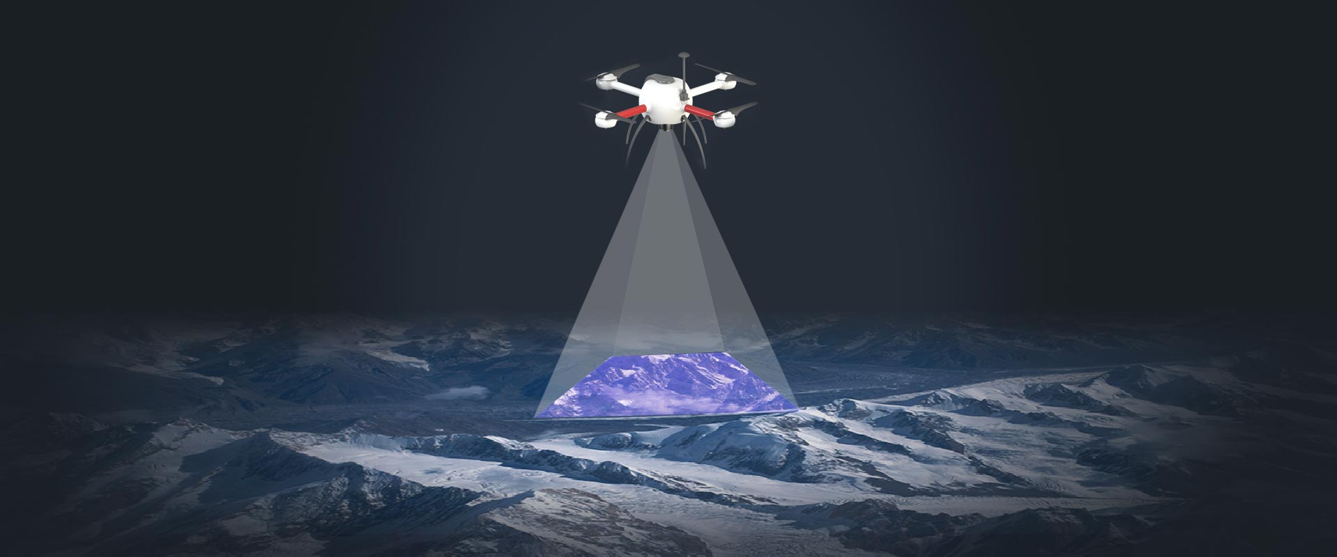
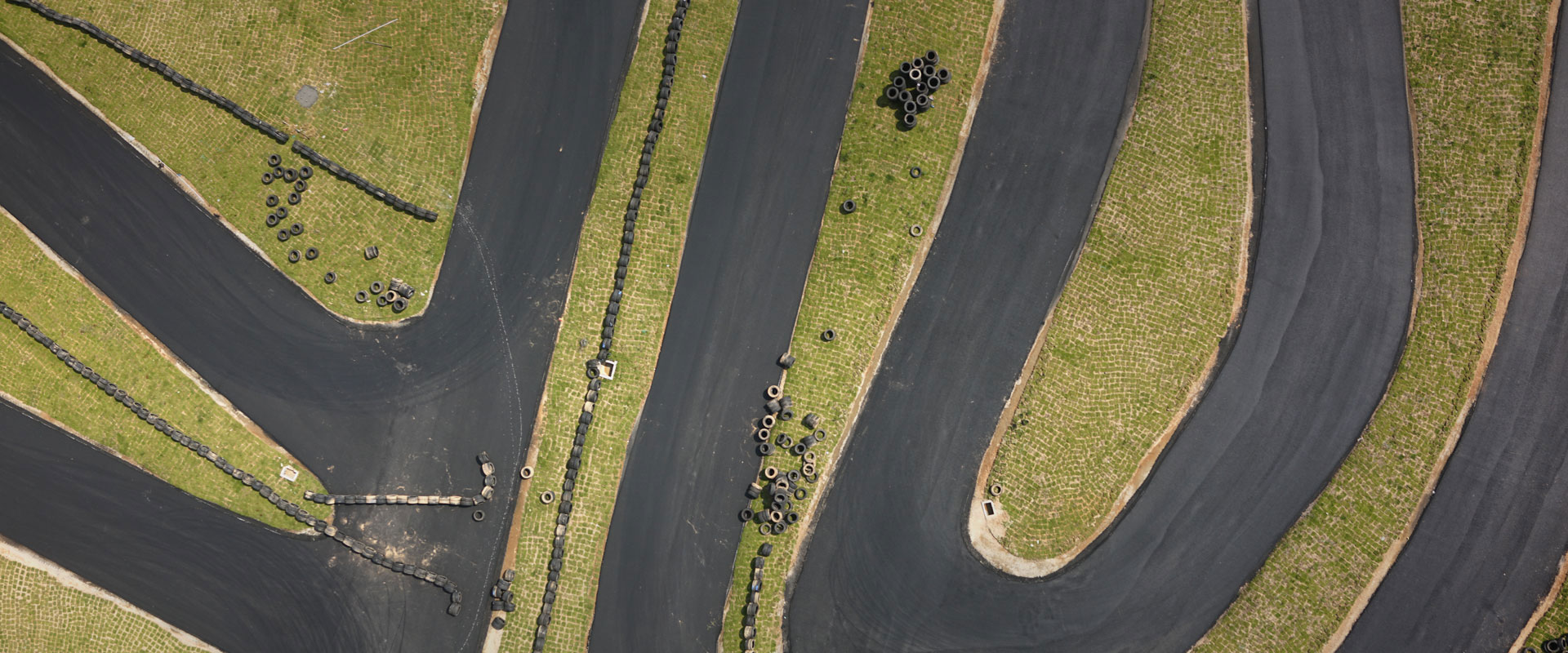
High-resolution mapping results
Full-frame sensors capture images with unrivaled resolution,
seamless image mosaic to get high quality mapping models for urban
planning, disaster evaluation, etc.
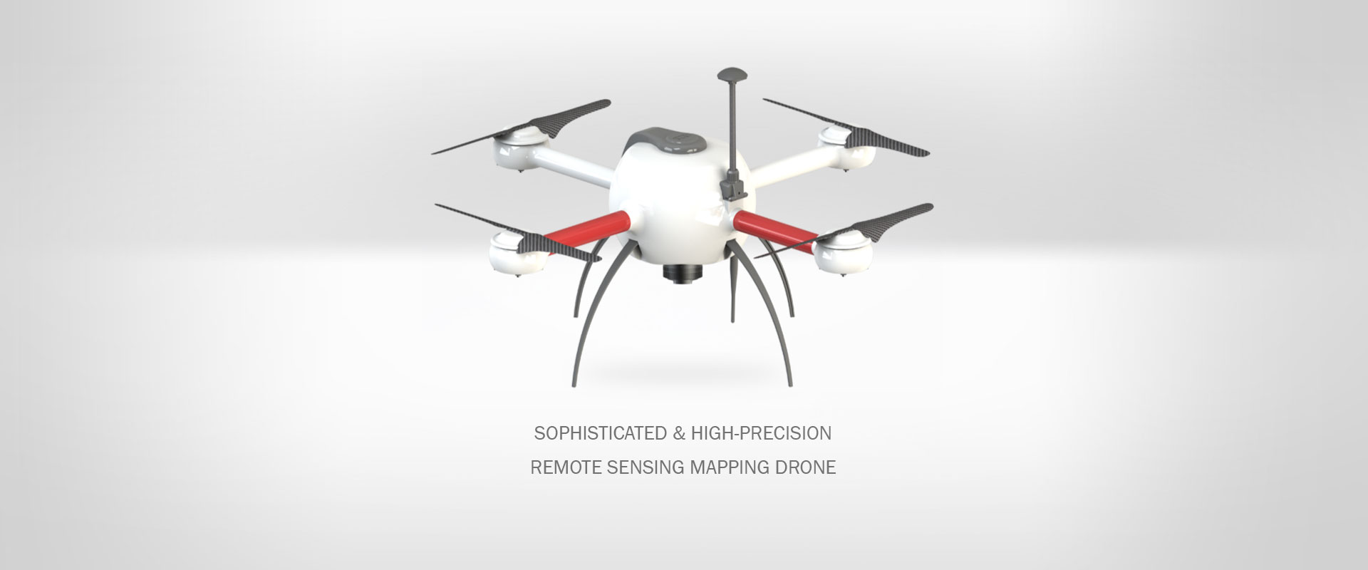
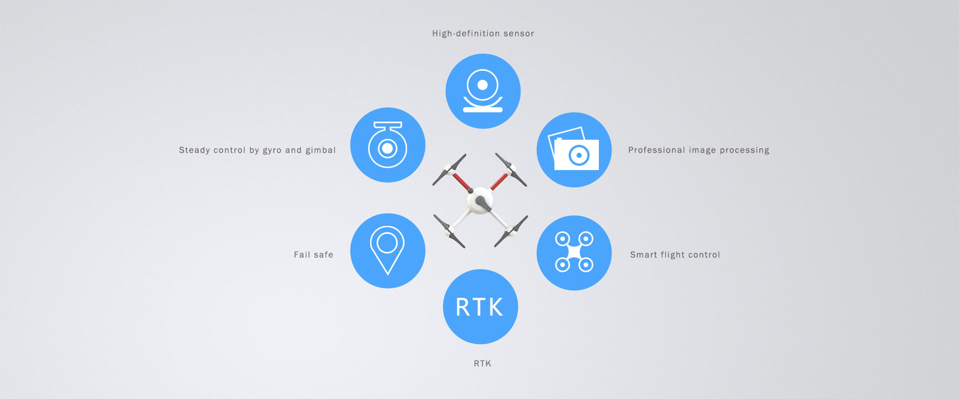
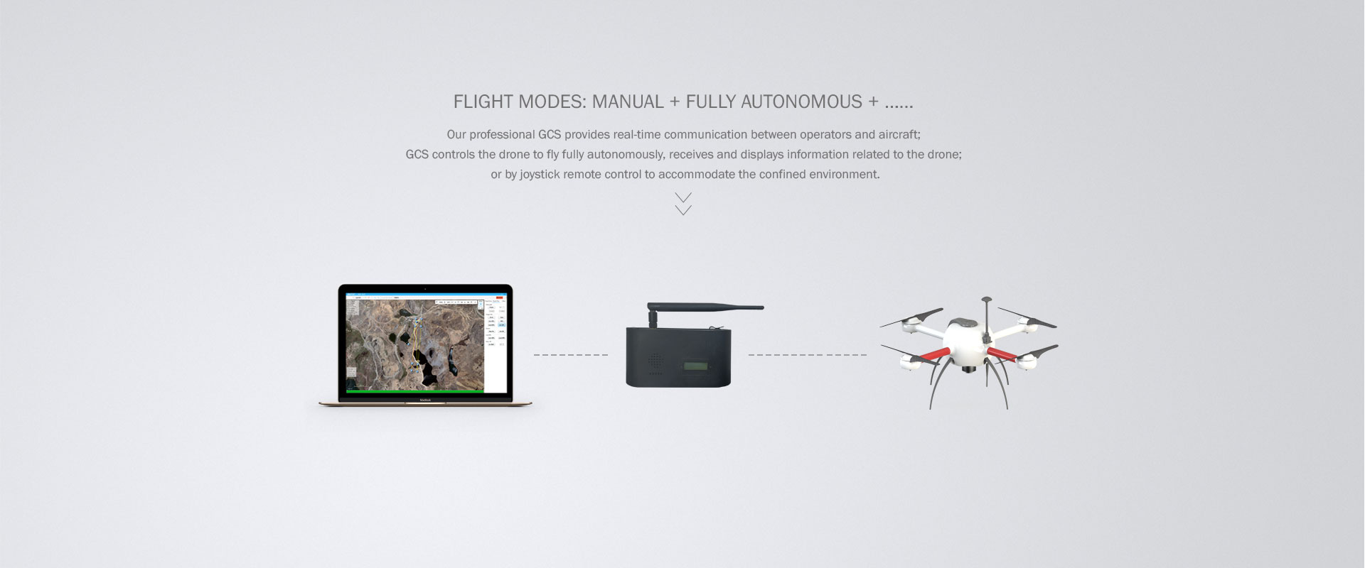
Intelligent flight
Skilled at accurate control of flight attitude and path, high steady
shot performance;
control the flight precision and stability using smart flight
control system; adjust the heading (yaw) even under auto mode.
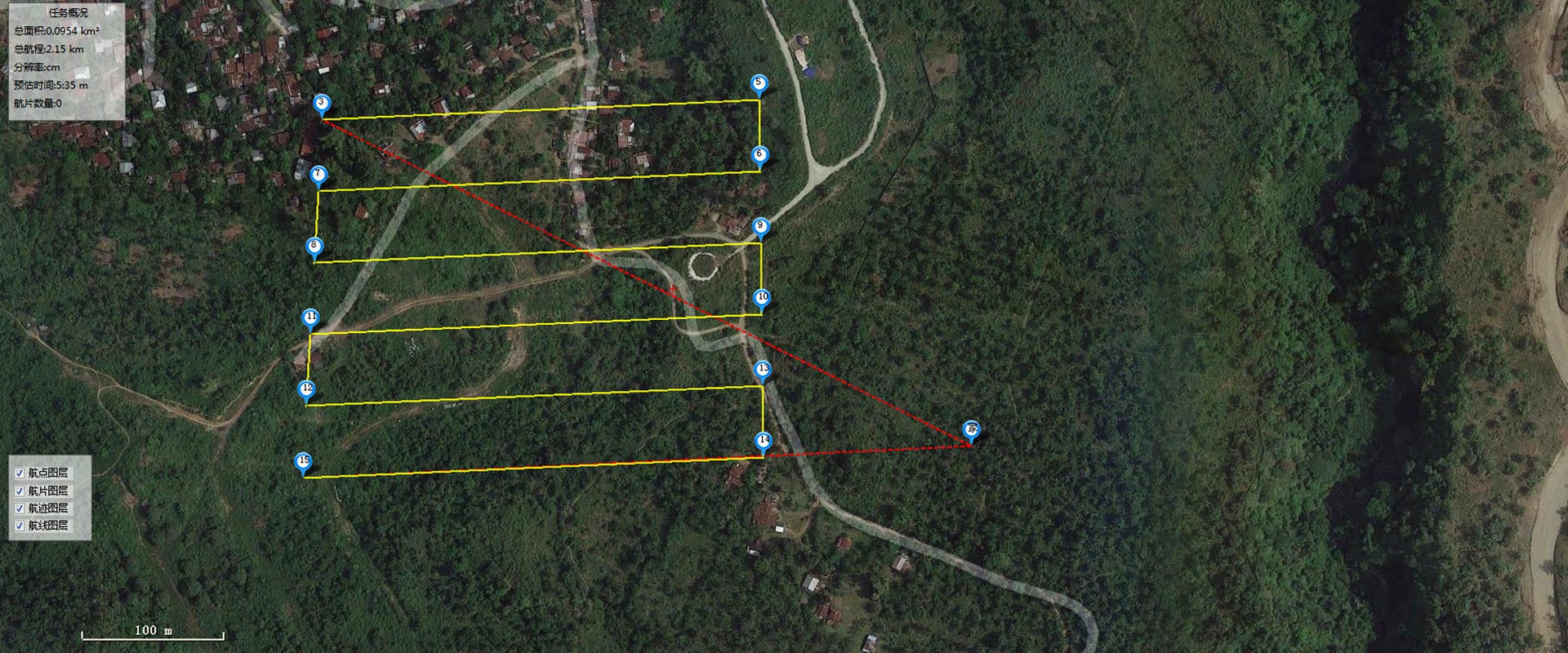
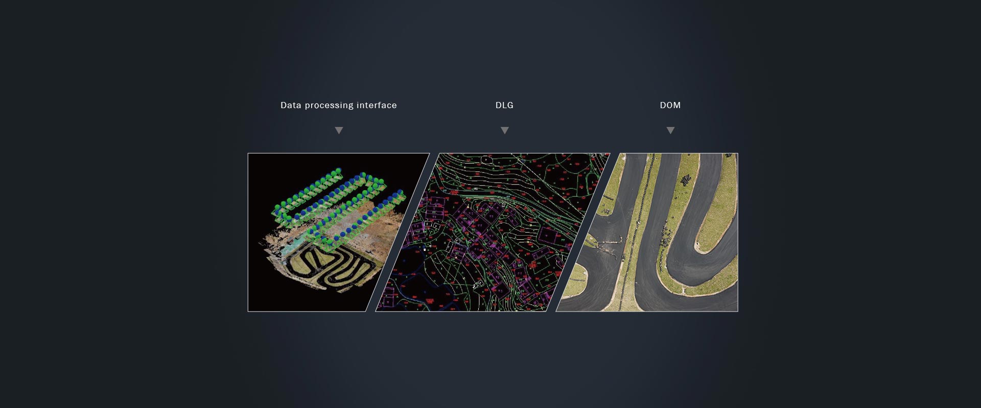
Professional data processing
We use professional data processors like Pix4D,
Agisoft and Trimble Inpho to create orthophoto mosaic, DLG,
topographic maps, DEM, contour maps, etc.